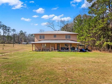
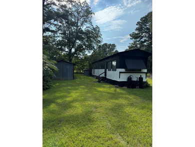
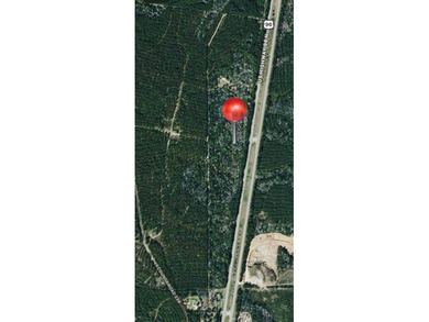
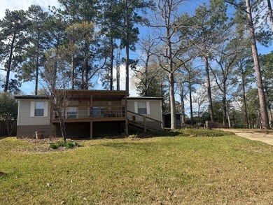
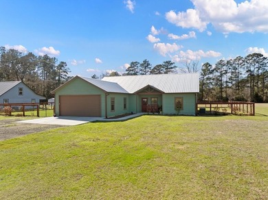
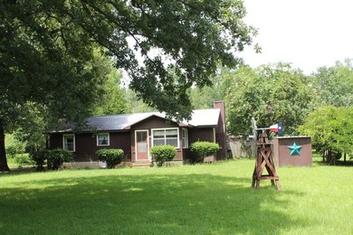
Are Jet Skis permitted on Lake Sam Rayburn ? Yes
|
Can you Swim in Lake Sam Rayburn ? Yes |
What is the Water Quality at Lake Sam Rayburn ? Good |
What is the Average water level variance at Lake Sam Rayburn ? Controlled by the US Army |
Are Boat Docks permitted at Lake Sam Rayburn ? No |
Are Power Boats permitted at Lake Sam Rayburn ? Yes |
What is the Lake Depth at Lake Sam Rayburn ? 50 feet + |
What are the Nearby Cities to Lake Sam Rayburn ? Broddus - 8 miles, Zavalla - 15 miles, Jasper – 14 Miles |
Lake Sam Rayburn Fishing Information |
|
More than 50 bass tournaments are held at the lake each year. Renown for large mouth bass fishing, Lake Sam Rayburn is also home to both black and white crappie, catfish, sunfish, white bass, hybrid striped bass, and spotted bass.
Considerable pre-impoundment timber remains standing and provides excellent fish habitat. Fish find ample cover in over 12,000 acres of hydrilla and another 2,500 acres of other types of vegetation. There are some brush piles, but these privately placed attractors do not play a significant role in Rayburn's environment.
|
Lake Sam Rayburn Camping Information |
|
On Sam Rayburn Rayburn Reservoir, Mill Creek Park, operated by the U.S. Corps of Engineers, is a highly developed area on the lake's southeast shore. The park is located off Loop 149 and U.S. Highway 96 at Brookeland, Texas. The park contains 110 campsites with electrical hook-ups, 57 of which have water connections. The park also features a group shelter, a designated swimming beach, boat launching ramps, three waterborne restrooms with hot showers, two trailer dumping stations. The park is open year around.
Camp Sites/Group Sites: 72/0
Camp Sites with Hookups/Electric/Water/Sewer Facilities: 0
# of Sites where Fees are Charged: 67
Camp Site Fees without/Elec (low/high): $6/$6
Martin Dies, Jr. State Park
|
Lake Sam Rayburn Local Area Businesses |
|
History of the lake:
Sam Rayburn Reservoir, formerly known as McGee Bend Reservoir, is dammed eighty miles north of Beaumont (at 31°04' N, 94°06' W). It is fed by the Angelina River and lies in Jasper, Angelina, Sabine, Nacogdoches, and San Augustine counties. Construction at the McGee Bend site began on September 7, 1956, and deliberate impoundment of water began on March 29, 1965. Paul Hardeman, Incorporated, of Stanton, California, served as general contractor for the project, which cost $63,290,000. The project was renamed in honor of Samuel T. (Sam) Rayburn in 1963.
The reservoir is designed for flood control and power generation, owned by the United States government, and operated by the United States Army Corps of Engineers, Fort Worth district. The earthfill dam has a spillway crest elevation of 176 feet and a top flood-control pool capacity of 3,997,600 acre-feet. Its two hydroelectric plants generate a total capacity of 52,000 kilowatt-hours marketed by the Southwestern Power Administration. With a drainage area of 3,449 square miles, Rayburn Reservoir conserves water for municipal, industrial, agricultural, and recreational purposes.
Sam Rayburn has thirteen developed recreation areas that are operated and managed by the U.S. Army Corps of Engineers, including : nine campgrounds, (primitive to highly developed), with more than 500 total campsites, sixteen multi-lane launch ramps, five group shelters, four picnic areas, four designated swimming areas, playground, volleyball, horseshoe and basketball facilities, interpretive trail, and more. In addition there are four out granted marinas operated by private concessionaires.
|